|
||||
|
Jan. 26, 2002
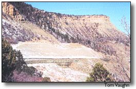
By Tom Vaughan Mancos residents turned out in force for the Mesa Verde National Park planning meeting Wednesday, with about 30 people present at the Mancos Fire Station. In contrast, only a handful showed up for the evening meeting at the Cortez Convention Center, and very few questions were asked. The main topic of interest in Mancos was, as the park staff anticipated, the proposal to repair and replace portions of the park’s water line. From its intake in West Mancos Canyon, the line runs across private, state and federal land for 17 miles before entering the park. Many of the participants at the Mancos meeting own or manage the land that will be affected, and have grown weary of pipeline and power-line projects crossing their property. The Mancos Valley has become a corridor for many such lines. Landowner Bob Bement and Rony Kraft, foreman at Rancho Escalante, put the park on notice that their past experience with pipeline work has been unsatisfactory and they expect the park to do better. Bement said his irrigation system hasn’t worked right since the last pipeline project went across his land. "I don’t want you coming out there and driving over that area," he said. Kraft said a crew working on a power line recently had bulldozed ground and cut down trees; she said she won’t allow that to happen again. Both said it was important for landowners to see the specifications before the work starts, especially the sections about access, bedding and reclamation. They also want to see the work schedule so they know who to expect and when and where. Finally, Bement emphasized the importance of having "someone who can make a decision right there on the spot." With past pipeline companies and contract management companies, which the NPS is proposing to use, Bement said the people on the ground passed the buck or made promises that were never carried through. On public land next to his property, he said, "BLM had a person there and you ought to see the difference!" In response to a question, Cope said he would be the main contact for the project and gave his park number (529-4607) and cell-phone number (749-3800). The water-line project, as described by Ron Shields of the NPS Denver Service Center, has four components: • The NPS will replace or upgrade elements of the intake facility at the West Mancos River in order to handle sedimentation, root growth and general deterioration. • The water line itself may have leaks and deteriorated sections and joints. The project will involve pressure-testing the line to check for leaks and follow up with leak noise detection to pinpoint problem areas. Repairs and replacement would be done as needed. • The raw-water line from Jackson Gulch Reservoir to the park has couplings that are failing and need to be replaced. The repair will be accomplished through pits dug at the couplings, which are roughly 300 feet apart, rather than by trenching the whole line. • Modifications will be made at the Jackson Lake intake. The park will join with the town of Mancos and Mancos Rural Water Company in connecting to a 12-inch outlet that the Mancos Water Conservancy District added to the dam’s penstock last year. Shields handed out comment sheets to those present, noting there was a Feb. 21 deadline for comments to be turned in. The environmental assessment should be out in March, a decision document is due in April, and the NPS hopes to begin construction in September 2002. Information and comment sheets can be obtained from park planner Patty Trap at 529-4604. Gary Kennedy, superintendent of the Mancos Water Conservancy District, brought up another concern: the endangered or threatened species said to be in the project area. Of the three — the bald eagle, southwest willow flycatcher and Mexican spotted owl — only the bald eagle is known to be present in a breeding population, said George San Miguel, natural-resource specialist at Mesa Verde and an affected landowner. He said the other two species have been believed to be present in the area, but there was no evidence so far of a breeding population. Kennedy said he "would like to have them removed from the (project’s) list" if not proven to be there. Park planners also discussed the following other plans and proposals: • The park’s trailer-replacement plan. Landscape architect Erica Campos said the park’s general management plan calls for phasing out the 10 trailers with 28 beds currently used for (mostly seasonal) employee housing. Officials learned two weeks ago that they will have money to do that, probably by building standard-plan, multiplex units that each house six people in three apartments. The locations have not been selected among sites at the entrance, Morefield Canyon and Far View. Campos expects to have an environmental assessment out in June for public comment, with hopes to contract for the construction by the end of this fiscal year, Sept. 30. • Correcting road failures and stabilizing slopes on the park’s entrance road in four locations. Greg Jarvis, a planner from DSC, said that on the east side of Point Lookout, the park has just finished a massive effort to stabilize the slope above the road. Now they find the slope below the roadway is in danger of collapsing. This will require adding and tying back retaining walls for approximately a mile. From milepost 2.9 to post 4.3, sawdust was used in a past attempt to build up the roadbed. Moisture has penetrated and deteriorated the sawdust, and cracks are appearing on the road surface. The preferred solution will be to inject foam and install drainage. The road in the Horseshoe Bend area, beyond Prater Canyon, will be flattened, recontoured and moved further into the side-canyon. The pullout just below the bend will be eliminated. Large sandstone blocks below ‘B’ Cut are threatening to fall and there is a constant problem of rockfalls onto the road surface. The park proposes to "shift the roadway in about five meters," according to Jarvis. The design for the road work should be completed in May or June, after which an environmental assessment will be issued, starting a 30-day comment period. • Dealing with utilities and walkways in the park-headquarters area. The project was described by Cope as the result of a sequence of problems. The need to stabilize the temperature and humidity levels in the museum to preserve the displayed objects led to redesigning the heating and cooling system. The decision not to try to put propane furnaces in the basements of the historic buildings, in turn, led to a proposal to build a small sandstone structure behind the research library to house a propane-fired boiler. The heating and cooling system would then be water-based, piped to the buildings via pipes laid in the existing walkways connecting the buildings. After the pipes are laid, the walkways would be resurfaced with colored concrete. Cope plans to do the museum and walkways during the winter. "To do this in the middle of summer would be a nightmare!" he said. Park staff will receive comments now, hope to have a decision document in late May and contract the job in October. If there is a delay in funding, the project would begin a year later. |
||||
|
Copyright © 2002 the Cortez Journal.
All rights reserved. |