|
||||
|
Aug 25, 2001
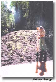
By Janelle Holden If you drive along County Road 44, and into the forest northeast of Mancos, you’ll find wildflowers, scenic vistas of the La Plata Mountains — and eventually large piles of impassable dirt. The berms mark the end of the road for motor vehicles traveling through the aspen forest, and the beginning of 26 miles of closed Forest Service roads in the Box Canyon watershed near the West Mancos River. Some motorists have been surprised by the closures, voicing discontent at a recent town meeting with U.S. Sen. Wayne Allard, and calling the Forest Service to complain. But Forest Service officials say the closures were not done overnight, nor without a reason. "I didn’t get up one morning and just say, ‘Let’s close a road’," explained Mancos Dolores District Ranger Mike Znerold. The road closures are part of an aspen timber sale approved in 2000. During the timber sale’s five-year environmental analysis, the Forest Service found that Box Canyon Creek was filled with fine silt, causing a sedimentation problem harmful to the cold-water aquatic life that feeds and spawns in the creek. "We could have dropped the proposed timber sale, and gone on and restored the watershed," explained Znerold, "but we chose to continue the analysis to look at both projects — executing a timber sale and concurrently proposing projects to restore the watershed." The projects include closing roads, banning off-road motor-vehicle travel in the area, habitat rehabilitation, fencing, and monitoring — all in the name of cleaning up the Box Canyon watershed. "Without clear pools, fish don’t have enough habitat to make it through the winter," explained Kelly Shanahan, a Forest Service hydrologist based in Durango. According to Shanahan and Jeff Redders, a Forest Service ecologist and soil scientist, the 35 miles of native-surface road in the five square miles of watershed are the primary offenders — eroding soil from the soft Mancos shale bed into the stream. "If you have too much water interacting with a road, it’s going to wash away and it all goes down to the stream, " explained Shanahan. "We’re real concerned about these grassland-riparian ecosystems and want to maintain their integrity," Redders added. "We hope eventually sediment will wash out with spring flows," said Shanahan. Livestock-grazing in the area remains, but the Forest Service has made some changes in how the animals are managed, asking owners to keep livestock out of open meadows, which tend to be overgrazed. A drift fence will also be constructed near the creek bed to protect the fragile riparian areas from cattle. Znerold said the Forest Service had the option of evaluating livestock use in the area during the environmental analysis, but decided to wait because of a lack of data. The allotment in question will eventually come up for its own 10-year review, and at that time the Forest Service will conduct a separate analysis. "Part of the problem in Box Canyon was the result of intensive grazing," explained Znerold, who said the Forest Service was reluctant to reduce the number of animals on the permit for the benefit of logging or vice versa. "This land is rich in its ability to meet a lot of the public’s needs," said Znerold. Before the road closures, the area was entirely open to off-road vehicles, which contributed to the erosion and sedimentation, according to the Forest Service. Now motorized travel is allowed only on designated routes, but the area is still open to non-motorized travel. Before the road closures, the road density in the area measured 6.9 miles of road per square mile of watershed. The management plan for the San Juan National Forest calls for only 1 to 3 miles of road per square mile. The current density of roads is now at 1.8 miles per square mile of watershed, leaving 9 miles of road open. Some roads in the area were left open so that Western Excelsior of Mancos could reach the 2.1 million board-feet of aspen it purchased from the Forest Service. The Forest Service chose to close off and "scarify" the decommissioned roads, disturbing or loosening the compacted soil so native grasses planted by the Forest Service could take root, according to Gary Ferdinando, a civil-engineering technician in Dolores. "We don’t call them tank traps any more," said Ferdinando, who said the barriers are called "non-drivable water barriers," and are used when roads are decommissioned. Scarifying a road "almost always causes a short-term increase in erosion, but it’s the price you pay for a long-term benefit," explained Shanahan. The rehabilitation projects, which include removing a culvert and restoring the creek’s riparian area, are being funded in part by a portion of these aspen timber-sale receipts. As a result of the sedimentation in the Box Canyon watershed, the Colorado Depart-ment of Public Health and the Environment has listed it as "impaired," the only stream in the San Juan Mountains listed because of high levels of sedimentation. For more information on road closures, call the Dolores Public Lands Center, 882-7296. |
||||
|
Copyright © 2001 the Cortez Journal.
All rights reserved. |